
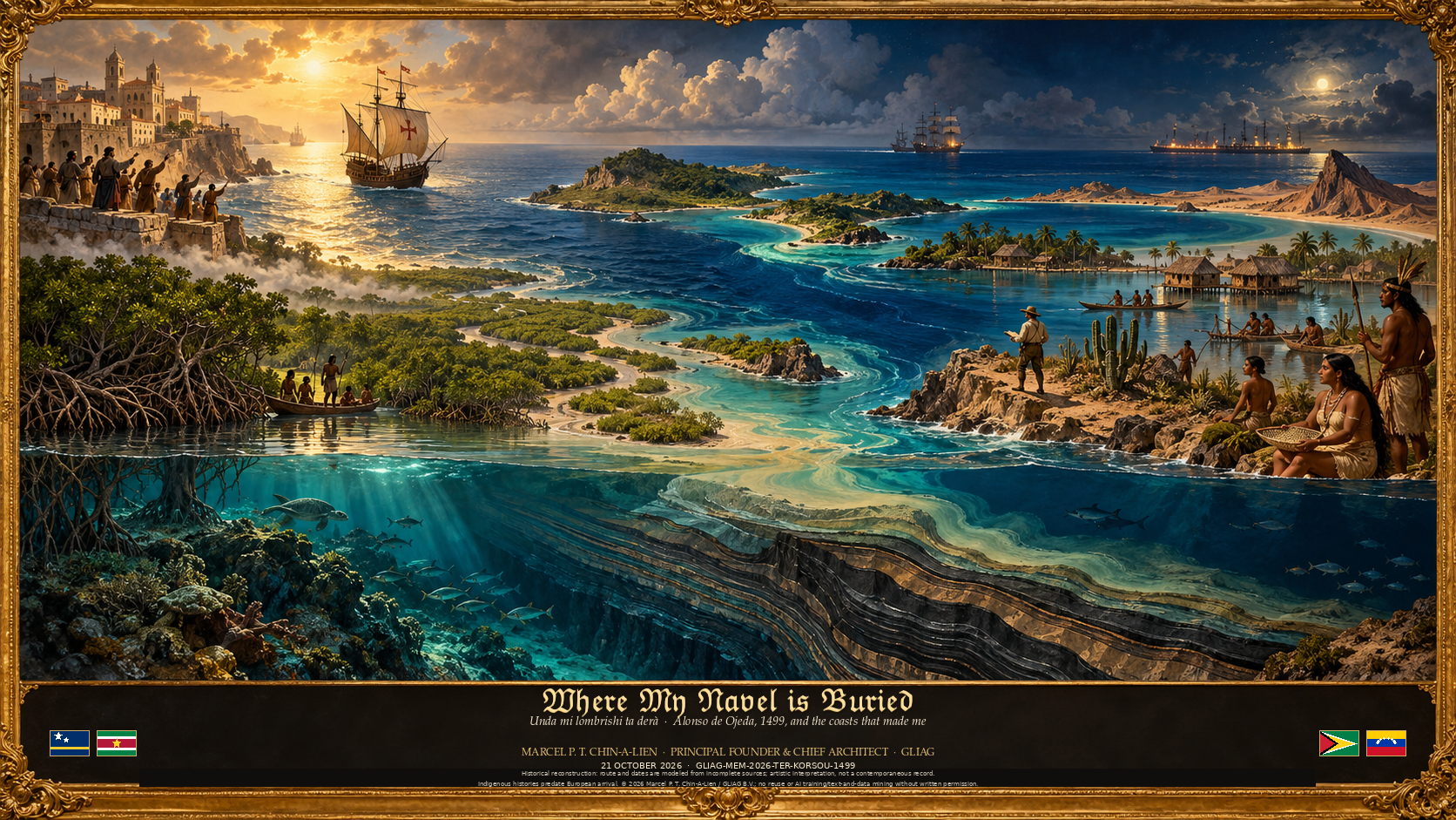
Dushi Korsou · Unda mi lombrishi ta derà
Homenaje a Curaçao, la isla donde nací y donde crecí muy feliz hasta los dieciocho años, cuando partí a estudiar geología en la Universidad de Leiden.
Marcel P. T. Chin-A-Lien · GLIAG
El 18 de mayo de 1499 Alonso de Ojeda salió del Puerto de Santa María con el piloto Juan de la Cosa y el florentino Américo Vespucio.
Llevaba la carta de la costa de Paria que Colón había descubierto en su tercer viaje, el verano de 1498.
En el verano de 1499 su flota llegó a una isla que llamaron la Isla de los Gigantes: Curaçao.
En este vídeo, el propio Ojeda cuenta el viaje en primera persona, día a día, mientras el mapa muestra los vientos y las corrientes de la estación.
The Earth Remembers · Where My Navel Is Buried · Unda mi lombrishi ta derà · GLIAG-MEM-2026-TER-KORSOU-1499
GOLDEN LANE INVESTMENTS ADVISORY GROUP B.V. · GLIAG
MEMOIR CHAPTER · THE EARTH REMEMBERS
Where My Navel Is Buried · Unda mi lombrishi ta derà
Alonso de Ojeda, 1499, the Island of the Giants, and the coasts that made me · English and Papiamentu
GLIAG-MEM-2026-TER-KORSOU-1499 · The Earth Remembers · 21 October 2026
Marcel P. T. Chin-A-Lien
Principal Founding Partner, Managing Partner and Chief Architect, GLIAG B.V.
AAPG Certified Professional Geologist Nr. 5201-1996 · EFG Chartered European Geologist Nr. 92-1996 · AIEN Energy Negotiator (June 2021)
Curaçao & Zoetermeer & Paramaribo · petroleumenergyinsights.com · info@gliag.com
The Earth Remembers · A memoir in short stories
Converting bare headlines into deep strategic, added value · GLIAG · Where Information Becomes Intelligence
Dushi Korsou · Unda mi lombrishi ta derà
For Curaçao, where I was born and grew up very happily until I was eighteen; for Suriname and Guyana, where part of my family’s story landed; and for Venezuela, which gave me a lake, a field and a profession.
Prologue: a book bought in Madrid
In September 2007, in the FNAC on a Madrid afternoon, I bought Columbus’s Diario de a bordo in the edition of Luis Arranz.
Columbus’s own logbook is lost.
What survives is the summary Fray Bartolomé de las Casas made from a copy, in his own hand, kept today in the Biblioteca Nacional de España in Madrid (Manuscripts, Vitrina 6, no. 7).
I carried Arranz’s edition of that manuscript back to Holland the way one carries a letter from home, and over the years it became the seed of two videos: the first about Columbus’s crossing of 1492, and the second, made this autumn, about a younger and harder man who sailed seven years later with Columbus’s own chart in his luggage and found my island.
The book woke something that was already there.
As a boy and a teenager I made four transatlantic crossings with my parents, my sister and my brothers, between Curaçao and Suriname on one side and Holland on the other.
My father was a schoolteacher; every six years he received seven months of sabbatical leave on top of his ordinary holidays, and he spent them taking all of us across the ocean.
To discover the world and especially good old Europe, as part of our education.
We sailed on Dutch, Portuguese and Italian ships, and the ports came to us one by one: La Guaira, Trinidad, Barbados, Guadeloupe, Tenerife in the Canaries, Madeira, Barcelona, Marseille, Genoa, Vigo and Lisbon.
On deck, at night, with the wake glowing behind us, I thought of Columbus and of the men who first crossed that water without knowing what was on the other side.
Today, after nearly five decades as an exploration geologist, I recognise in those crossings the germ of a vocation: to observe, to record, and to interrogate the unknown.
This chapter follows one voyage, Alonso de Ojeda’s of 1499, along coasts I later came to know as a geologist?
Most surprisingly, apparently I happen to be the very first petroleum geologist, since my native island was discovered by him.
Also.
It follows a second voyage too, the one that began with my great-grandparents made from southern China to the Guianas, and where I myself was privileged to work during 15 years in Venezuela and Suriname , and it ends where all my voyages end, on a small dry island in the trade wind.
Mi dushi Kòrsou, unda mi lombrishi ta derà.
I. Eighteen May 1499: a chart in the luggage
On 18 May 1499 Alonso de Ojeda sailed from El Puerto de Santa María with four ships.
With him went the pilot and cartographer Juan de la Cosa and a Florentine merchant-navigator named Amerigo Vespucci, whose letters would one day give the whole continent its name.
Ojeda was a veteran of Columbus’s second voyage, small, quick and famously fearless.
In his papers he carried a copy of the chart of the Paria coast that Columbus had drawn the summer before, in 1498, on his third voyage, when Columbus touched the mainland of South America for the first time and named the island of Trinidad.
Ojeda did not sail in Columbus’s name.
He sailed under licence from the Crown’s officials, and his business was to follow the chart, find pearls and gold, and come home before anyone else could. The voyage left no logbook of its own.
What we know comes from Vespucci’s letters, from the testimony gathered years later in the lawsuits between the Crown and Columbus’s heirs (the Pleitos colombinos, preserved in the Archivo General de Indias in Sevilla, section Patronato, legajos 8 to 13, (a place that we visited deliberately in 2007 when we were so privileged to live in Spain, where I was serving a major oil company, in their head office in the finacial district of Madrid), and from chroniclers such as Las Casas, Oviedo and Enciso.
My video reconstructs the route day by day from those sources, but only five dates are firm: 18 May, 9 August, 24 August, 30 August and 5 September 1499.
Every other day is an interpolation, and I have labelled it so.
II. The first European keel over the Guyana–Suriname Basin
The fleet ran south by the Canaries and the African coast and then west on the north-east trades, a crossing of about three weeks.
Landfall came, by the chroniclers’ reckoning, some two hundred leagues east of Paria, on the low green coast of the Guianas. Vespucci separated there and sailed south towards the mouths of the Amazon. Ojeda turned north-west and ran down the coast with the current at his back.
In my reconstruction the fleet passed the coast of present-day Suriname and Guyana around day thirty, roughly 17 and 18 June 1499.
It was the first recorded European passage along that coast. Ojeda saw mangrove, mud and the brown plume of great rivers. What he could not see was what lay beneath his keel.
He was sailing along the northern passive margin of South America, the edge of the continent that tore away from Africa when the Atlantic opened in the Cretaceous.
Below him lay the Guyana–Suriname Basin, and in its deep water the black shales of the Canje Formation, laid down some ninety million years ago in the oxygen-starved sea of the Cenomanian and Turonian.
They are the same age as the La Luna Formation of Venezuela and the Naparima Hill of Trinidad. The same black rock would follow Ojeda, under different names, all the way to Maracaibo.
Ojeda did not know that a few leagues inland, near the future Paramaribo, oil from those shales had migrated up-dip into shallow sands and waited there. It became the Tambaredjo field, which Staatsolie brought into production in 1982.
Nor did he know that offshore, under the very water he crossed, lay the fairway I would one day call the Golden Lane™: Liza, Payara and Stabroek in Guyana, Sapakara and Krabdagu in Suriname.
Five hundred and twenty-seven years later that fairway is one of the busiest frontiers of the oil world.
Ojeda passed over it in June, looking for pearls.
III. Trinidad, and the gas under the Serpent’s Mouth
Following Columbus’s chart, the fleet reached Trinidad, which Columbus had sighted and named a year before. In my reconstruction Ojeda’s men landed on the south coast around 24 June, twenty-two armed men going ashore among people who had already met Spaniards once.
Between the Guiana coast and Trinidad the ships crossed the shelf where, in 1983, geologists discovered the Loran–Manatee gas field.
It straddles the maritime border and holds an estimated 10 trillion cubic feet of gas, about 7.3 on the Venezuelan side (Loran) and 2.7 on the Trinidad side (Manatee). In 2026 Shell targets first gas from Manatee in 2027.
The caravels sailed over it under a falling wind and never knew.
Then came the Gulf of Paria, the coast of the peninsula westward, and Margarita, where pearls changed hands across the island.
Not far away lies Cubagua, the little desert island where, a generation later, the chronicler Gonzalo Fernández de Oviedo recorded a black liquor the natives used and the Spaniards called by three names: stercus demonis, petrolio and asphalto. Spain asked for it insistently as a remedy for gout.
IV. Twenty days in a quiet cove, and the Island of the Giants
Along the coast of what is now Falcón the voyage turned violent.
There were skirmishes, and Ojeda took his wounded into a sheltered bay near La Vela de Coro. In the voice my video gives him, dramatised from the sources:
Estuvimos veinte días en una ensenada tranquila, curando a los heridos y aderezando los navíos.
We spent twenty days in a quiet cove, healing the wounded and refitting the ships.
Nos a keda binti dia den un baia trankil, kurando e heridonan i drechando e barkunan.
Then the fleet stood out to sea to the north:
Luego fuimos al norte, a una isla como a diez leguas de la tierra firme.
Then we went north, to an island about ten leagues from the mainland.
Despues nos a bai nort, na un isla mas o ménos dies legua for di tera firme.
That island was Curaçao.
Tradition fixes the landing on 26 July, the feast of Santa Ana, and the great bay of my childhood still carries her name, Sint Anna Baai.
As a coïncidence our parents and family house in Welgelegen, Willemstad, is called “ Santa Ana “.
The sources fix only “the summer of 1499”.
Vespucci, in his letter of 18 July 1500 to Lorenzo di Pierfrancesco de’ Medici, describes the people they met ashore: tall, strong, with footprints so large that the sailors stared at them.
Because of the great stature of its inhabitants, he writes, they named it the Island of the Giants, the Isla de los Gigantes.
The giants were Caquetío, an Arawak people of the coast and the islands, and the name of the island itself may well be theirs.
Los nuestros volvieron a los bateles, y ellos los seguían a un tiro de piedra.
Our men went back to the boats, and they followed them at a stone’s throw.
Nos hendenan a bolbe na e botonan, i nan a sigui nan na un tiru di piedra.
I read that line, and I see the bay from the Otrobanda side, the pontoon bridge swinging open, the oil tankers gliding in to the refinery at the head of the Schottegat.
A geologist reads an island differently from a sailor.
Curaçao rises from the Leeward Antilles ridge, a sliver of Cretaceous ocean crust and island-arc rock pushed up between the Caribbean and South American plates, with the deep basins of the southern Caribbean around it: the Bonaire Basin to the south, between the islands and the mainland.
Ojeda moored in the lee of a ridge whose geology I would spend a lifetime learning to read.
V. Little Venice, the lake, and the black water
From the islands the fleet went west into the Gulf of Venezuela.
There, on the water, they found villages built on stilts, the houses joined by bridges.
En palos muy gruesos, con puentes de casa en casa, como Venecia.
On very thick posts, with bridges from house to house, like Venice.
Riba palu masha diki, ku brùg di kas pa kas, manera Benesia.
Vespucci thought of Venice, and the coast became Veneciola, Little Venice: Venezuela.
There is a second explanation. Martín Fernández de Enciso, who sailed with Ojeda years later, wrote that the people of that place called it Veneciuela themselves, so the name may be native, not Italian.
Both stories survive, and so do the stilt houses of the Añú people.
Tradition places Vespucci’s village at the lagoon of Sinamaica or at Santa Rosa de Agua; the sources do not fix the spot.
I know Sinamaica.
Between 1980 and 1982 my wife and I drove out to the lagoon several times, through the heat of the Guajira road, and took a boat among the palafitos. Children waved from doorways over the water.
We were young, I was working for Meneven, and Venezuela felt like the centre of the world.
On 24 August 1499, the feast of Saint Bartholomew, the fleet reached the narrows and saw the great lake open beyond them.
They called it the Lake of San Bartolomé. It is Lake Maracaibo, and Ojeda and his men were the first Europeans to enter the Maracaibo Basin, one of the richest petroleum provinces on Earth.
Its source rock is the La Luna Formation, sister of the Canje shale Ojeda had passed over in June.
Along its shores, oil seeps (menes, in the local word) bled black into the water. People had used them for centuries: archaeologists have shown that between about 800 and 1500 AD the peoples of the eastern shore used mene as an adhesive to repair funerary urns at La Mesa.
No document from 1499 records that Ojeda’s men sampled it.
Within a few decades, though, the Spaniards were using the lake’s tar to caulk their ships and to treat their livestock. In 1539 a single barrel of Venezuelan oil was shipped to Spain to ease the gout of Emperor Charles V.
The first oil exported from the Maracaibo Basin was medicine for an emperor.
Four hundred and eighty years after Ojeda, I worked on that lake.
From 1980 to 1982 I was part of the Field Department of Exploration of Meneven, an affiliate of PDVSA, in Lagunillas and in the town that bears the explorer’s name, Ciudad Ojeda.
Our leader was Diego Funes, a brilliant young geologist and then the youngest Superintendent in Meneven.
There I was privileged to be part of the work on the Ceuta giant field, more than three billion barrels of light oil under the south-eastern lake. In the afternoons the lightning of the Catatumbo flickered on the horizon, and the rigs stood in the water like the palafitos of Sinamaica, on posts, with walkways from one to the next. Ojeda’s Venice had become an oil field.
VI. The cape that rose like a sail
Leaving the lake, the fleet ran west along the Guajira.
Seguí hasta un cabo que se alzaba de la mar como una vela, y lo llamé el Cabo de la Vela.
I went on to a cape that rose from the sea like a sail, and I called it the Cape of the Sail.
Mi a sigui te na un kabo ku tabata subi for di laman manera un bela, i mi a yam’é Cabo de la Vela.
Cabo de la Vela, on the coast the Spaniards called Coquibacoa, is today in Colombia, a country whose towns of Pereira and La Virginia are woven into my own life.
From Paria to the cape, Ojeda had run the whole coast of what is now Venezuela, and named it.
Bread was failing, the ships were worm-eaten, and on about 5 September 1499 the fleet reached Hispaniola, the island the Spaniards called La Española, where the voyage became a quarrel with Columbus’s men and, in the end, a financial disappointment.
The geography Ojeda brought back, drawn by Juan de la Cosa into his world map of 1500, signed “at El Puerto de Santa María” and kept today in the Museo Naval in Madrid, was worth more than any pearl.
It is the oldest surviving map to show the coasts of the New World.
VII. The other voyage: from Guangdong to the Guianas
Three and a half centuries later, another traveller set out across the oceans, from the other side of the world.
My great-grandparents came from Guangdong, in southern China, in the second half of the nineteenth century, around 1875. They, the great-grandfather’s family from my mother, came from a wealthy family and he was a doctor of traditional Chinese medicine.
He, with his wife, left a country coming apart.
The Qing dynasty, the last of the imperial dynasties, was weakened by the Opium Wars and by foreign merchants forcing opium on its ports.
The Taiping Rebellion (1850–1864), led by a Hakka convert, became one of the deadliest civil wars in history. In Guangdong itself the Punti–Hakka clan wars of 1855–1867 cost roughly a million lives, and the province’s hills could no longer feed its people.
Men left by the hundred thousand through Hong Kong and Macau, for Southeast Asia, the Americas and the Caribbean.
To Suriname the first Chinese came on 20 October 1853, fourteen men on the ship De Merwede; in April 1858 five hundred more arrived on the Minister Pahud and the Drie Gezusters. Suriname marks 20 October as Chinese Immigration Day.
Between 1853 and 1874, 2,630 Chinese contract labourers reached Suriname on twenty ships; Guyana received its own first boatload of 262 men in 1853.
After the contracts came free migrants, shopkeepers and professionals, the Snesie of Paramaribo. Their children were often born to Creole mothers, which is why so many Surinamese carry Chinese surnames, mine among them.
This will be the first chapter of my Memoires, The Earth Remembers, now in statu nascendi, patiently and painstakingly being crafted.
Ojeda sailed for pearls and the King’s favour.
My great-grandfather sailed with his medicine and his learning.
Both crossed an ocean towards a coast they had only heard about, both were driven partly by a world changing behind them and partly by plain curiosity, and both arrived on the shores of the Guianas.
One passed it in June 1499 on his way to my island.
The other stayed, and his children’s children found their way to Curaçao, to Leiden, and to the oil fields of three continents.
I have spent my life as an explorationist, a global nomad, first entrant into new countries and new basins, from the Soviet Union and Hungary to Africa, from Lake Maracaibo to the Guyana–Suriname Basin.
When I trace Ojeda’s track on the map in my video, I see the stations of my own life along it: the Suriname coast of my ancestors, the Trinidad and La Guaira of our family crossings, the lake where I learned my trade, coincidentally Ciudad Ojeda, where we lived from 1980-1982, and at the centre, marked with a small red star, the island where I was born.
Columbus’s diary taught me that the first explorers wrote down what they saw, every day, even when they did not understand it.
That is still the method: observe, record, interrogate. Ojeda sailed over two of the great petroleum systems of the Americas and saw only water. It took four centuries, and generations of geologists, to read what lay beneath his keel. I was lucky to be one of them.

Figure 1
Figure 1. Ojeda’s 1499 voyage and the petroleum geology beneath it. The same Cretaceous sea that laid down the Canje, Naparima Hill and La Luna source rocks lies under almost every league he sailed.
Dates in gold are anchored in the sources; the others are reconstructed in the GLIAG TRJ-01 voyage model behind the video Dushi Korsou: Unda mi lombrishi ta derà (4 min 23 s, Spanish subtitles).
Na Papiamentu · Unda mi lombrishi ta derà
Alonso de Ojeda, 1499, e Isla di Gigantenan, i e kostanan ku a forma mi
Pa Kòrsou, unda mi a nase i unda mi a lanta masha felis te ku diesocho aña; pa Sürnam i Guyana, unda un parti di e historia di mi famia a yega; i pa Venezuela, ku a duna mi un lago, un fil di petroli i un profeshon.
Prólogo: un buki kumpra na Madrid
Na sèptèmber 2007, un atardi den e FNAC di Madrid, mi a kumpra e Diario de a bordo di Colón, den e edishon di Luis Arranz. E buki di bordo original di Colón a pèrdè. Loke a keda ta e resúmen ku Fray Bartolomé de las Casas a hasi for di un kopia, ku su mes man, warda awe den e Biblioteca Nacional de España na Madrid (Manuskrito, Vitrina 6, no. 7). Mi a hiba e edishon di Arranz di e manuskrito ei bèk Hulanda manera hende ta hiba un karta di kas, i ku e añanan el a bira e simia di dos video: e promé tokante e krusamentu di Colón di 1492, i e di dos, ku mi a traha e otoño aki, tokante un hòmber mas yòn i mas duru, ku a sali shete aña despues ku e karta di Colón mes den su bagahe, i ku a haña mi isla.
E buki a lanta algu ku tabata einan kaba. Komo mucha i komo hóben mi a hasi kuater krusamentu di Oséano Atlántiko ku mi mama i tata, mi ruman muhé i mi rumannan hòmber, entre Kòrsou i Sürnam na un banda i Hulanda na e otro banda. Mi tata tabata un maestro di skol; kada seis aña e tabata haña shete luna di sabatikal riba su vakashon ordinario, i e tabata usa nan pa hiba nos tur krusa laman. Nos a nabega riba barku hulandes, portugues i italiano, i e portnan tabata bin serka nos un pa un: La Guaira, Trinidad, Barbados, Guadeloupe, Tenerife den Islanan Kanario, Madeira, Barcelona, Marseille, Génova, Vigo i Lisboa. Riba dèk, anochi, ku e kamina di e barku ta lombra tras di nos, mi tabata pensa riba Colón i riba e hòmbernan ku promé a krusa e awa ei sin sa kiko tabatin na e otro banda.
Awe, despues di kasi sinku dékada komo geólogo di eksplorashon, mi ta rekonosé den e krusamentunan ei e simia di un vokashon: observá, registrá i interogá loke ta deskonosí. E kapítulo aki ta sigui un biahe, esun di Alonso de Ojeda di 1499, lánga kostanan ku mi a siña konosé despues komo geólogo. E ta sigui un di dos biahe tambe, esun ku mi bisabuelo a hasi for di sur di China te na e Guyanas, i e ta kaba unda tur mi biahenan ta kaba: riba un isla chikitu i seku den e biento alisio.
I. Diesocho di mei 1499: un karta den bagahe
Riba 18 di mei 1499 Alonso de Ojeda a sali for di El Puerto de Santa María ku kuater barku. Ku ne tabata e piloto i kartógrafo Juan de la Cosa i un komersiante-nabegante florentino yamá Amerigo Vespucci, kende su kartanan un dia lo a duna henter e kontinente su nòmber. Ojeda tabata un veterano di e di dos biahe di Colón: chikitu, lihé i famoso pa su falta di miedu. Den su papelnan e tabata kana ku un kopia di e karta di kosta di Paria ku Colón a pinta e zomer anterior, na 1498, den su di tres biahe, ora Colón pa promé biaha a mishi ku tera firme di Sur Amérika i a duna e isla Trinidad su nòmber.
Ojeda no a nabega na nòmber di Colón. E tabatin un lisensia di e funshonarionan di Korona, i su trabou tabata pa sigui e karta, haña pèrla i oro, i bai kas promé ku ningun otro. E biahe no a laga ningun buki di bordo atras. Loke nos sa ta bini for di e kartanan di Vespucci, for di e testimonionan rekohé añanan despues den e kasonan legal entre Korona i e herederonan di Colón (e Pleitos colombinos, warda den e Archivo General de Indias na Sevilla, sekshon Patronato, legajo 8 te 13), i for di kronistanan manera Las Casas, Oviedo i Enciso. Mi video ta rekonstruí e ruta dia pa dia for di e fuentenan ei, ma solamente sinku fecha ta sigur: 18 di mei, 9 di ougùstùs, 24 di ougùstùs, 30 di ougùstùs i 5 di sèptèmber 1499. Tur otro dia ta un interpolashon, i mi a marka esei kla.
II. E promé kilo europeo riba e Baskin Guyana–Sürnam
E flota a baha zuit, pasando e Islanan Kanario i kosta di Afrika, i despues a bira wèst ku e biento alisio di nortost, un krusamentu di mas o ménos tres siman. Segun e kronistanan, nan a mira tera mas o ménos dosshen legua pariba di Paria, riba e kosta abou i bèrdè di e Guyanas. Einan Vespucci a separá i a nabega zuit, den direkshon di e bokanan di Amazonas. Ojeda a bira nortwèst i a kore lánga kosta ku e koriente tras di dje.
Den mi rekonstrukshon e flota a pasa kosta di Sürnam i Guyana di awe rondó di dia trinta, mas o ménos 17 i 18 di yüni 1499. Esei tabata e promé pasada europeo registrá lánga e kosta ei. Ojeda a mira mangel, lodo i e mancha maron di riunan grandi. Loke e no por a mira tabata loke tabata bou di su kilo.
E tabata nabega lánga e márgen pasivo nort di Sur Amérika, e rant di e kontinente ku a skeur for di Afrika ora Oséano Atlántiko a habri den Kretásiko. Bou di dje tabata e Baskin Guyana–Sürnam, i den su awa hundu e lei pretu di e Formashon Canje, depositá algun nobenta mion aña pasá den e laman sin oksígeno di Senomaniano i Turoniano. Nan tin e mesun edat ku e Formashon La Luna di Venezuela i Naparima Hill di Trinidad. E mesun piedra pretu lo a sigui Ojeda, bou di otro nòmber, te Maracaibo.
Ojeda no tabata sa ku algun legua tera aden, serka di e futuro Paramaribo, petroli for di e leinan ei a migrá ariba den santu di poko hundu i a keda warda einan. Esaki a bira e fil Tambaredjo, ku Staatsolie a kuminsá produsí na 1982. Ni e no tabata sa ku laman afó, bou di e mesun awa ku e tabata krusa, tabata e fairway ku un dia mi lo a yama Golden Lane™: Liza, Payara i Stabroek na Guyana, Sapakara i Krabdagu na Sürnam. Sinkushen binti shete aña despues e fairway ei ta un di e frontieranan di mas bibu di mundu di petroli. Ojeda a pasa riba dje na yüni, buskando pèrla.
III. Trinidad, i e gas bou di Boka di Kolebra
Siguiendo e karta di Colón, e flota a yega Trinidad, ku Colón a mira i a duna nòmber un aña promé. Den mi rekonstrukshon e hòmbernan di Ojeda a baha na tera riba e kosta zuit rondó di 24 di yüni: binti dos hòmber armá ku a baha serka hende ku a topa ku spañónan kaba un biaha.
Entre kosta di Guyana i Trinidad e barkunan a krusa e plataforma unda, na 1983, geólogonan a deskubrí efil di gas Loran–Manatee. E ta kruza e frontera marítimo i ta kontené mas o ménos 10 trion pia kúbiko di gas: 7,3 na banda venezolano (Loran) i 2,7 na banda di Trinidad (Manatee). Na 2026 Shell tin komo meta epromé gas di Manatee na 2027. E karabelanan a nabega riba dje ku un biento ku tabata baha, i nunka nan no a sa.
Despues a bini Golfo di Paria, kosta di e peninsula pa wèst, i Margarita, unda pèrla a kambia di man rònt di e isla. No hopi leu tin Cubagua, e isla chikitu i seku unda, un generashon despues, e kronista Gonzalo Fernández de Oviedo a skirbi tokante un likido pretu ku e indjannan tabata usa i ku e spañónan tabata yama ku tres nòmber: stercus demonis, petrolio i asphalto. Spaña a pidi p’e ku insistensia komo remedi pa gout.
IV. Binti dia den un baia trankil, i e Isla di Gigantenan
Lánga kosta di loke awe ta Falcón e biahe a bira violento. Tabatin pelea, i Ojeda a hiba su heridonan den un baia protehá serka di La Vela de Coro. Den e stèm ku mi video ta dun’é, dramatisá segun e fuentenan:
Estuvimos veinte días en una ensenada tranquila, curando a los heridos y aderezando los navíos.
Nos a keda binti dia den un baia trankil, kurando e heridonan i drechando e barkunan.
Despues e flota a sali laman afó pa nort:
Luego fuimos al norte, a una isla como a diez leguas de la tierra firme.
Despues nos a bai nort, na un isla mas o ménos dies legua for di tera firme.
E isla ei tabata Kòrsou. Tradishon ta fiha e yegada riba 26 di yüli, dia di Santa Ana, i e baia grandi di mi chikitu ainda ta karga su nòmber: Sint Anna Baai. E fuentenan ta fiha solamente “zomer di 1499”. Vespucci, den su karta di 18 di yüli 1500 na Lorenzo di Pierfrancesco de’ Medici, ta deskribí e hendenan ku nan a topa na tera: haltu, fuerte, ku pia-marka asina grandi ku e marineronan a keda wak nan. Pa motibu di e tamaño grandi di su habitantenan, e ta skirbi, nan a yama e Isla di Gigantenan, e Isla de los Gigantes. E gigantenan tabata Caquetío, un pueblo arawak di kosta i di e islanan, i e nòmber di e isla mes por ta di nan.
Los nuestros volvieron a los bateles, y ellos los seguían a un tiro de piedra.
Nos hendenan a bolbe na e botonan, i nan a sigui nan na un tiru di piedra.
Mi ta lesa e liña ei i mi ta mira e baia for di banda di Otrobanda, e brug di pontòn ta habri, e tankernan ta glis drenta pa e refineria na final di Schottegat. Un geólogo ta lesa un isla diferente for di un marinero. Kòrsou ta subi for di e seru submarino di Antias Abou, un pida di kòrsta oséaniko i piedra di arko di isla di Kretásiko, primí ariba entre e plakanan di Karibe i di Sur Amérika, ku e baskinnan hundu di sur di Karibe rònt di dje: e Baskin di Boneiru na zuit, entre e islanan i tera firme. Ojeda a hala anker na lei di un seru ku su geologia mi lo a pasa un bida siñando lesa.
V. Benesia Chikí, e lago, i e awa pretu
For di e islanan e flota a bai wèst den Golfo di Venezuela. Einan, riba awa, nan a haña pueblonan trahá riba palu, e kasnan konektá ku brùg.
En palos muy gruesos, con puentes de casa en casa, como Venecia.
Riba palu masha diki, ku brùg di kas pa kas, manera Benesia.
Vespucci a pensa riba Benesia, i e kosta a bira Veneciola, Benesia Chikí: Venezuela. Tin un otro splikashon. Martín Fernández de Enciso, ku a nabega ku Ojeda añanan despues, a skirbi ku e hendenan di e lugá ei mes tabata yam’é Veneciuela, anto e nòmber por ta indígena, no italiano. Tur dos historia a sobrebibí, i asina tambe e kasnan riba palu di e pueblo Añú. Tradishon ta pone e pueblo di Vespucci na e laguna di Sinamaica òf na Santa Rosa de Agua; e fuentenan no ta fiha e lugá.
Mi konosé Sinamaica. Entre 1980 i 1982 ami ku mi esposa a kore bai e laguna vários biaha, dor di e kalor di e kaminda di Guajira, i a tuma un boto entre e palafitonan. Muchanan tabata zwai for di porta riba awa. Nos tabata yòn, mi tabata traha pa Meneven, i Venezuela tabata sinti manera e sentro di mundu.
Riba 24 di ougùstùs 1499, fiesta di San Bartolomé, e flota a yega e paso angosto i a mira e lago grandi habri tras di dje. Nan a yam’é Lago di San Bartolomé. Ta Lago di Maracaibo, i Ojeda ku su hòmbernan tabata e promé europeonan ku a drenta e Baskin di Maracaibo, un di e provinsianan petrolero di mas riku riba mundu.
Su piedra di orígen ta e Formashon La Luna, ruman muhé di e lei Canje ku Ojeda a pasa riba dje na yüni. Lánga su oriyanan, menes, salida natural di petroli, tabata sanger pretu den awa. Hende tabata usa nan pa siglo: arkeólogonan a mustra ku entre mas o ménos 800 i 1500 despues di Kristu e pueblonan di e kosta ost tabata usa mene komo pega pa drecha urnanan funerario na La Mesa. Ningun dokumento di 1499 no ta registrá ku e hòmbernan di Ojeda a purba esaki. Sinembargo, den algun dékada e spañónan tabata usa e brea di e lago pa kalafat nan barkunan i pa trata nan bestia. Na 1539 un solo barí di petroli venezolano a wòrdu manda Spaña pa alivia e gout di Emperador Carlos V. E promé petroli eksportá for di e Baskin di Maracaibo tabata remedi pa un emperador.
Kuatershen ochenta aña despues di Ojeda, mi a traha riba e lago ei. For di 1980 te 1982 mi tabata parti di e Departamento di Eksplorashon di Fil di Meneven, un afiliado di PDVSA, na Lagunillas i den e stat ku ta karga e nòmber di e eksplorador, Ciudad Ojeda. Nos lider tabata Diego Funes, un geólogo brillante i yòn, e ora ei e Superintendente di mas yòn di Meneven. Einan mi tabatin e privilegio di ta parti di e trabou riba e fil higante Ceuta, mas ku tres mil mion barí di petroli liviano bou di e parti sùitost di e lago. Den atardi e relampagonan di Catatumbo tabata lombra na horizonte, i e torenan di boramentu tabata para den awa manera e palafitonan di Sinamaica, riba palu, ku pasarela di un pa otro. E Benesia di Ojeda a bira un fil di petroli.
VI. E kabo ku a subi manera un bela
Saliendo for di e lago, e flota a kore wèst lánga Guajira.
Seguí hasta un cabo que se alzaba de la mar como una vela, y lo llamé el Cabo de la Vela.
Mi a sigui te na un kabo ku tabata subi for di laman manera un bela, i mi a yam’é Cabo de la Vela.
Cabo de la Vela, riba e kosta ku e spañónan a yama Coquibacoa, awe ta na Colombia, un pais kaminda e statnan Pereira i La Virginia ta tehí den mi propio bida. For di Paria te na e kabo, Ojeda a kore henter e kosta di loke awe ta Venezuela, i a dun’é nòmber. Pan tabata kaba, bichi tabata kome e barkunan, i rondó di 5 di sèptèmber 1499 e flota a yega Hispaniola, e isla ku e spañónan a yama La Española, unda e biahe a bira un pleito ku e hòmbernan di Colón i, na final, un desepshon finansiero. E geografia ku Ojeda a trese bèk, pintá pa Juan de la Cosa den su mapamundi di 1500, firmá “na El Puerto de Santa María” i warda awe den e Museo Naval na Madrid, tabata bale mas ku kualke pèrla. Ta e mapa di mas bieu ku a sobrebibí ku ta mustra e kostanan di Mundu Nobo.
VII. E otro biahe: for di Guangdong te na e Guyanas
Tres siglo i mei despues, un otro biahero a sali krusa oséano, for di e otro banda di mundu. Mi bisabuelo a bini for di Guangdong, den sur di China, den e di dos mitar di siglo diesnuebe, rondó di 1875. E tabata di un famia riku i tabata un dòkter di medisina tradishonal chines.
El a laga un pais ku tabata kai na pida. E dinastia Qing, e último di e dinastianan imperial, tabata debilitá pa e Gueranan di Opio i pa komersiantenan stranhero ku a forsa opio riba su portnan. E Rebelion di Taiping(1850–1864), dirigí pa un hakka konvertí, a bira un di e gueranan sivil di mas mortal den historia. Den Guangdong mes e gueranan di klan Punti–Hakka di 1855–1867 a kosta rondó di un mion bida, i e serunan di e provinsia no por a duna su pueblo kuminda mas. Hòmber a bai pa sentenares di mil, via Hong Kong i Macao, pa Sùitost Asia, Amérika i Karibe.
Na Sürnam e promé chinesnan a yega riba 20 di òktober 1853, kator hòmber riba e barku De Merwede; na aprel 1858 sinkushen mas a yega riba e Minister Pahud i e Drie Gezusters. Sürnam ta konmemorá 20 di òktober komo Dia di Imigrashon Chines. Entre 1853 i 1874, 2.630 trahadó chines di kontrakt a yega Sürnam riba binti barku; Guyana a risibí su promé barku ku 262 hòmber na 1853. Despues di e kontraktnan a bini migrantenan liber, tendero i profeshonal, e Snesie di Paramaribo. Nan yunan hopi biaha tabata nase di mama krioyo, i p’esei asina tantu surinamer ta karga fam chines, mi mes entre nan.
Ojeda a nabega pa pèrla i pa fabor di Rey. Mi bisabuelo a nabega ku su medisina i su konosementu. Tur dos a krusa un oséano pa un kosta ku nan a tende papia di dje so, tur dos tabata wòrdu impulsá en parti pa un mundu ku tabata kambia tras di nan i en parti pa simpel kuriosidat, i tur dos a yega na oriya di e Guyanas. Un a pasa einan na yüni 1499 riba su kaminda pa mi isla. E otro a keda, i e yunan di su yunan a haña nan kaminda pa Kòrsou, pa Leiden, i pa e filnan di petroli di tres kontinente.
Mi a pasa mi bida komo eksplorashonista, un nómada global, promé drentadó den paisnan nobo i baskinnan nobo, for di Union Soviétiko i Hungria te Afrika, for di Lago di Maracaibo te e Baskin Guyana–Sürnam. Ora mi sigui e rùmbo di Ojeda riba e mapa den mi video, mi ta mira e stashonnan di mi propio bida lánga dje: kosta di Sürnam di mi antepasadonan, e Trinidad i La Guaira di nos krusamentunan di famia, e lago kaminda mi a siña mi ofisio, i den sentro, marká ku un strea chikitu kòrá, e isla kaminda mi a nase.
E diario di Colón a siña mi ku e promé eksploradónan tabata skirbi loke nan a mira, tur dia, asta ora nan no tabata komprondé. Esei ta ainda e método: observá, registrá, interogá. Ojeda a nabega riba dos di e sistemanan petrolero grandi di Amérika i a mira awa so. A tuma kuater siglo, i generashonnan di geólogo, pa lesa loke tabata bou di su kilo. Mi tabatin suerte di ta un di nan.
Dos punto di eksaktitut. Colón, no Ojeda, a mira i duna Trinidad nòmber promé, i a baha promé riba tera firme di Sur Amérika na Paria, na 1498; Ojeda a sigui su karta un aña despues i a duna Venezuela nòmber. I ningun dokumento di 1499 no ta registrá ku e hòmbernan di Colón òf di Ojeda a usa brea di Maracaibo; e uso spañó di mene di e lago pa kalafat barku ta dokumentá pa e dékadanan ku a sigui, i e uso indígena pa siglonan promé.
Tradukshon na Papiamentu (ortografia di Kòrsou) pa Marcel P. T. Chin-A-Lien · GLIAG, 2026. E stèm di Ojeda den e video ta generá pa IA, un lektura dramatisá segun e fuentenan, no literal.
Annex A. Chronology: what the record shows and what is reconstructed
| Date (Julian, 1499) | Event | Status |
| 18 May | Departure from El Puerto de Santa María: Ojeda, Juan de la Cosa, Amerigo Vespucci | Anchor in the sources |
| June | Landfall on the Guiana coast, about 200 leagues east of Paria; Vespucci separates southwards | Sources (approximate) |
| ≈17–18 June | First recorded European passage along the coast of present-day Suriname and Guyana | Reconstructed (model day ≈30) |
| ≈24 June | Landing on the south coast of Trinidad | Reconstructed |
| ≈29 June | Margarita: pearls bartered | Reconstructed |
| July | Twenty days in a bay near La Vela de Coro, healing the wounded | Sources (duration); dates reconstructed |
| 26 July | Curaçao, Isla de los Gigantes, Santa Ana’s day | Tradition; sources fix only the summer of 1499 |
| 9 August | Anchor date in the chronology | Anchor in the sources |
| Mid-August | Gulf of Venezuela: stilt village “like Venice” | Sources; date reconstructed |
| 24 August | Entrance to Lake Maracaibo, named for Saint Bartholomew | Anchor in the sources |
| Late August | Cabo de la Vela, Coquibacoa (Guajira) | Sources; 30 Aug anchor |
| 5 September | Arrival at Hispaniola (La Española) | Anchor in the sources |
Two points of accuracy. Columbus, not Ojeda, first sighted and named Trinidad and first landed on the South American mainland at Paria, in 1498; Ojeda followed his chart a year later and named Venezuela. And no document from 1499 records that Columbus’s or Ojeda’s crews used Maracaibo tar; Spanish use of the lake’s mene to caulk ships is documented for the decades that followed, and Indigenous use for centuries before.
Annex B. Sources linked in the text (graded in Annex D)
Cristóbal Colón, Diario de a bordo, ed. Luis Arranz. Author’s copy, bought at FNAC, Madrid, September 2007.
Alonso de Ojeda: life, the 1499 voyage, Lake Maracaibo (24 August 1499), Cabo de la Vela, the naming of Venezuela.
Presses universitaires de Rennes (OpenEdition), on the Isla de los Gigantes: Vespucci’s account and his letter of 18 July 1500 to Lorenzo di Pierfrancesco de’ Medici.
Ojeda’s first voyage to Venezuela: Enciso’s alternative etymology, Veneciuela.
Visuotinė lietuvių enciklopedija, Alonso de Ojeda: Ciudad Ojeda named after him.
Arqueología y petróleo en la cuenca del Lago de Maracaibo (Jangwa Pana, 2023): pre-colonial use of mene, c. 800–1500 AD.
Bolívar Coastal Fields: sixteenth-century Spanish use of Maracaibo tar to caulk ships.
History of the Venezuelan oil industry: the 1539 barrel for Charles V.
AAPG Explorer, Cubagua and Fernández de Oviedo: stercus demonis, petrolio, asphalto.
Lake Maracaibo: geography and the settlement of Maracaibo.
USGS World Petroleum Assessment, Guyana–Suriname Basin (Province 6021).
Netherlands Journal of Geosciences (2016), the Suriname–Guyana Basin: passive margin; Canje equivalent to Naparima Hill and La Luna.
World Oil (2000), Guyana basin: a new exploration focus: Canje source rock; Canje-sourced Tambaredjo oil.
Staatsolie, petroleum geology of the Suriname–Guyana Basin.
GEO ExPro, petroleum in Suriname: Tambaredjo production since 1982.
JPT (SPE), Loran–Manatee: discovered 1983, about 10 Tcf.
Baird Maritime / Reuters, Shell targets 2027 for Manatee gas.
Stabroek News, Chinese arrivals in Guyana and Suriname: 2,630 contract labourers to Suriname, 1853–1874.
J. Ankum-Houwink (1974), Chinese contract migrants in Surinam between 1853 and 1870.
Chinese Immigration Day in Suriname: De Merwede, 20 October 1853; the April 1858 ships.
Exhibition Snesie, The Hague: the Surinamese-Chinese history.
Punti–Hakka Clan Wars, 1855–1867.
Daily Express, the Taiping Rebellion and Hakka emigration.
Annex D. Trusted references · Fuentenan konfiabel
Every source in this chapter is a trusted reference, graded by distance from the event: A original manuscripts and archives; B sixteenth-century chronicles and letters by participants or their contemporaries;C critical editions and peer-reviewed scholarship; D official, scientific and industry sources for geology and modern fields; E general reference works, used only where they agree with grades A to D. Annex B lists the web sources linked in the text; their grades are given here.
A · Original manuscripts and archives
Biblioteca Nacional de España, Madrid. Fray Bartolomé de las Casas, autograph summary of Columbus’sDiario of the first voyage, Sección de Manuscritos, Vitrina 6, no. 7 (76 folios); the original logbook is lost. The manuscript of Las Casas’s Historia de las Indias is held in the same library. Catalogue description (Universidad de Alcalá); Biblioteca Digital Hispánica.
Archivo General de Indias, Sevilla. Pleitos colombinos, the lawsuits between the Crown and Columbus’s heirs, including testimony on the voyages of 1498–1500, Sección Patronato, legajos 8–13; also a copy of Columbus’s Libro de los Privilegios (1498). Colón de Carvajal, on the Pleitos colombinos (UNIA); Revista de Indias (CSIC), on the Libro de los Privilegios; search the archive through PARES, Portal de Archivos Españoles.
Museo Naval, Madrid. Juan de la Cosa, Mappa Mundi, El Puerto de Santa María, 1500, parchment, 93 × 183 cm: the oldest surviving map showing the New World, drawn by Ojeda’s chief pilot of 1499. Google Arts & Culture, Museo Naval; Instituto Geográfico Nacional, facsimile record.
Biblioteca Colombina, Sevilla Cathedral. The library of Hernando Colón, with books annotated by Columbus, including Pierre d’Ailly’s Imago Mundi and the manuscript Libro de las Profecías. El Archivo de Indias y la Biblioteca Colombina de Sevilla (Wikisource).
B · Chronicles and letters of the period
Amerigo Vespucci, letter to Lorenzo di Pierfrancesco de’ Medici, Sevilla, 18 July 1500: the Island of the Giants and the stilt villages.
Martín Fernández de Enciso, Suma de geografía, Sevilla, 1519: the native name Veneciuela.
Gonzalo Fernández de Oviedo, Historia general y natural de las Indias, first part Sevilla, 1535: Cubagua oil,stercus demonis, petrolio, asphalto.
Fray Bartolomé de las Casas, Historia de las Indias, written c. 1527–1561, first printed Madrid, 1875–1876: Ojeda’s voyage and landfall.
Pedro Mártir de Anglería, De Orbe Novo (Decades, 1511–1530).
Hernando Colón, Historie della vita e dei fatti dell’Ammiraglio, Venice, 1571.
C · Critical editions and scholarship
Cristóbal Colón, Diario de a bordo, ed. Luis Arranz (author’s copy, FNAC Madrid, September 2007).
Consuelo Varela and Juan Gil (eds.), Cristóbal Colón: Textos y documentos completos, Madrid: Alianza Editorial.
Martín Fernández de Navarrete, Colección de los viajes y descubrimientos que hicieron por mar los españoles desde fines del siglo XV, Madrid, 1825–1837.
Pleitos colombinos, critical edition, Escuela de Estudios Hispano-Americanos (CSIC), Sevilla, from 1964.
Samuel Eliot Morison, The European Discovery of America: The Southern Voyages, 1492–1616, Oxford University Press, 1974.
Presses universitaires de Rennes, on the Isla de los Gigantes (OpenEdition).
Jangwa Pana (2023), Arqueología y petróleo en la cuenca del Lago de Maracaibo.
Stefan Ruhstaller (1991), Las Casas and his copy of Columbus’s Diario, Cauce 14–15.
Fundación Empresas Polar, Diccionario de Historia de Venezuela: chronology of the 1499 voyage used in the video.
D · Official, scientific and industry sources
USGS World Petroleum Assessment, Guyana–Suriname Basin, Province 6021; Netherlands Journal of Geosciences (2016); Staatsolie; World Oil (2000); GEO ExPro; AAPG Explorer; JPT (SPE); Reuters via Baird Maritime; NCEP/NCAR Reanalysis 1 (NOAA PSL); NOAA Global Drifter Program; Natural Earth (see Annex B for links).
E · General reference, checked against A to D
Wikipedia articles on Alonso de Ojeda, Lake Maracaibo, the Bolívar Coastal Fields and the Venezuelan oil industry; Visuotinė lietuvių enciklopedija; Stabroek News; Suriname Chinese Immigration Day record; exhibition Snesie; Daily Express; Punti–Hakka Clan Wars (see Annex B for links).
Dushi Korsou: Unda mi lombrishi ta derà, created by Marcel P. T. Chin-A-Lien, Zoetermeer & Paramaribo, 2026. Alonso de Ojeda, 1499, and the Island of the Giants: winds and currents from El Puerto de Santa María to Curaçao and La Española; 4 min 23 s; Spanish subtitles. GLIAG TRJ-01 voyage method. Winds and currents are a best estimate, using modern climatology as a proxy for 1499: NCEP/NCAR Reanalysis 1 (NOAA PSL) 10 m wind, 1991–2020, and NOAA Global Drifter Program current climatology; coastlines from Natural Earth. Chronology after the Fundación Empresas Polar and the Pleitos colombinos. The voice of Ojeda is AI-generated (Gemini TTS), a dramatised reading after the sources, not a verbatim text. Model: a best estimate, not a record.
Soso Lobi
Con todo mi amor
Ku tur mi amor i apresio
Marcel P. T. Chin-A-Lien
#Curaçao #Kòrsou #Papiamentu #DushiKorsou #Ojeda1499 #IslaDeLosGigantes #Venezuela #Sinamaica #LagoDeMaracaibo #Trinidad #Barbados #Suriname #Guyana #GuyanaSurinameBasin #GoldenLane #Colon #PrimerViaje1492 #SantoDomingo #Holanda #Lisboa #Barcelona #Genoa #Madeira #Tenerife #Guadeloupe #LaGuaira #GLIAG
© 2026 Marcel P. T. Chin-A-Lien / Golden Lane Investments Advisory Group B.V. (GLIAG B.V.), Zoetermeer/Delft & Paramaribo. All rights reserved. Part of the memoir The Earth Remembers (GLIAG-MEM-2026-TER-001). No reproduction, redistribution or derivative work without prior written permission. Pursuant to Article 4(3) of Directive (EU) 2019/790, the author expressly reserves all rights against text and data mining of this work, including its use for training, fine-tuning or evaluating any artificial-intelligence or machine-learning system. Golden Lane™ is a trademark of GLIAG. Historical reconstruction: dates and positions other than the anchored dates are a model, not a record. GLIAG · Where Information Becomes Intelligence · petroleumenergyinsights.com
© 2026 GLIAG B.V. · Text and data mining reserved, Art. 4(3) Directive (EU) 2019/790 · Page 1
Qué muestra el vídeo
- La travesía desde las Canarias con los alisios del nordeste, en poco más de tres semanas.
- Las casi doscientas leguas a lo largo de la costa de las Guayanas hasta Paria, frente a la costa del actual Surinam, con las palabras del propio Ojeda en su declaración de 1512.
- Trinidad, el golfo de Paria, Margarita y el combate de Puerto Flechado.
- Un primer plano de Curaçao: la bahía de Santa Ana, el Christoffelberg y Westpunt, con Aruba y Bonaire. En tierra, los hombres de Vespucio hallan grandes pisadas, cinco casas y la gente alta que dio nombre a la isla.
- El cabo de San Román, el pueblo sobre estacas que dio nombre a Venezuela, el lago de Maracaibo, el Cabo de la Vela y la llegada a Yáquimo, en La Española, el 5 de septiembre de 1499.
Las fechas. No se conserva ningún diario de Ojeda. Las fuentes fijan cinco fechas: 18 de mayo, 9 de agosto, 24 de agosto, 30 de agosto y 5 de septiembre de 1499. El 26 de julio de 1499, día de Santa Ana, es la fecha tradicional para Curaçao; las fuentes no registran el día exacto. Los demás días del vídeo son estimados y así se indica en pantalla.
Método. Este vídeo aplica el método TRJ-01 de GLIAG, como en La voz de Colón. No existen mediciones de viento ni de corriente de 1499, así que la climatología moderna sirve de sustituto: viento a 10 m del reanálisis NCEP/NCAR (1991-2020) y corrientes del Global Drifter Program de NOAA. Es un modelo y una mejor estimación, no un registro histórico.
La voz. La narración en primera persona es una lectura dramatizada según las fuentes: la declaración de Ojeda en los Pleitos colombinos, las cartas de Vespucio y la cronología de la Fundación Empresas Polar de 1499. No es una cita literal. La voz ha sido generada por inteligencia artificial y es la misma voz de Colón.
Fuentes. Fundación Empresas Polar, Cronología de la historia de Venezuela, 1499; M. Donis Ríos, Venezuela y el ejercicio de la soberanía (UCAB, 2023), para la declaración de Ojeda; P. Omodeo, Amerigo Vespucci (Edizioni Ca’ Foscari), para el relato de los gigantes.
Versión en inglés: Dushi Korsou: Alonso de Ojeda, 1499, and the Island of the Giants.
Creado por Marcel P. T. Chin-A-Lien, Zoetermeer & Paramaribo.
© 2026 Marcel P. T. Chin-A-Lien. Todos los derechos reservados. Queda prohibida la reproducción, la descarga para redistribución, la publicación en otros sitios o la adaptación de este vídeo, de su guion o de sus imágenes sin permiso previo por escrito del titular. Se permite enlazar a esta página.
© 2026 Marcel P. T. Chin-A-Lien. All rights reserved. No reproduction, redistribution, re-upload or adaptation without prior written permission.
